


Metar-Taf is a comprehensive weather application designed specifically for aviation enthusiasts and professionals. The app provides visualized METAR and TAF weather information for airports worldwide, presenting data in easy-to-understand, colorful metrics. With features like crosswind calculations, flight rules categorization, and text-to-speech functionality, users can efficiently decode and listen to METAR reports while multitasking.
In addition to its robust METAR capabilities, Metar-Taf offers detailed TAF breakdowns displayed hourly in tables, complete with sunrise/sunset times and temperature extremes. Users can track their favorite stations, access observations near their location, and search airports by ICAO code or name. The app also includes historical weather trend graphs and customizable units for a personalized experience. Whether you're a pilot, dispatcher, or aviation enthusiast, Metar-Taf equips you with the essential tools to stay informed about current and forecasted aviation weather conditions.
Metar-Taf stands out with its extensive feature set tailored for aviation weather analysis. The app's METAR section includes intuitive weather symbols, similar to non-aviation weather reports, alongside precise crosswind calculations achieved by combining METAR and runway information. The innovative text-to-speech function allows users to listen to decoded METAR reports hands-free, enhancing multitasking capabilities.
The TAF portion of the app breaks down terminal aerodrome forecasts into hourly tables, displaying vital information such as sunrise/sunset times and minimum/maximum temperatures. Users can maintain lists of favorite stations for quick reference, obtain local weather observations, and explore an interactive map with weather codes. Advanced features include historical weather trend graphs, customizable measurement units, and automatic time conversion based on airport location. Furthermore, the app supports offline use and offers multilingual accessibility in English, Dutch, Spanish, Portuguese, German, and French, making it an indispensable tool for international aviation professionals.
Accurate weather forecasting is crucial for aviation safety and planning. Metar-Taf provides visualized METAR and TAF weather information for airports worldwide, ensuring pilots have reliable data to make informed decisions.
The app breaks down complex meteorological reports into easy-to-understand metrics with colorful visuals and symbols. It includes detailed analyses such as crosswind calculations, flight rule categories, and temperature trends, all based on real-time and historical data.
Users benefit from precise weather summaries that include sunrise and sunset times, minimum and maximum temperatures, and visibility graphs. This comprehensive approach ensures that the forecasts are not only accurate but also highly credible, making it an indispensable tool for both professional aviators and enthusiasts.
Understanding weather patterns over time and space is essential for effective flight planning. Metar-Taf offers extensive temporal and spatial forecast ranges, providing users with detailed hourly breakdowns of Terminal Aerodrome Forecasts (TAF) in a tabular format.
The application tracks weather trends using graphs for various parameters like temperature, visibility, wind speed, and QNH pressure settings. These insights cover current conditions as well as changes observed over the past hours, allowing users to anticipate future developments accurately.
Additionally, Metar-Taf supports global airport searches by ICAO code or name, displaying relevant meteorological data at each location. With localized time conversions and automatic offline data saving, this feature empowers users to access critical information anytime, anywhere, enhancing their situational awareness significantly.
User-friendly interface
Comprehensive weather data
Offline functionality
Multilingual support
Customizable units
Occasional data delays
Limited free features
Advanced aviation focus
Requires technical knowledge
Subscription fees apply

Arrive safely! Travel weather forecasts for your entire trip at time of arrival.
 3.60
3.60
Live Alabama weather from James Spann—forecasts, radar, alerts, Spanncams.
4.70
Track rainfall totals with ease using our rain gauge app. Accurate rain tracker.
4.50
Super-res, real-time weather radar. Be prepared for extreme weather.
4.50
Weather radar, satellite, wind, waves, ocean and hurricane forecasts.
4.70
Stay ahead of the weather with Daily Weather
4.10
Weather watch face for Wear OS 5
4.40
Magnetic Compass meets smart tech: Get directions and weather alerts seamlessly
3.30
Hyperlocal Forecasts, Live Radar, Severe Weather alerts & Homescreen Widgets
4.30
Weather - Local weather forecast, weather daily & hourly, weather radar
4.80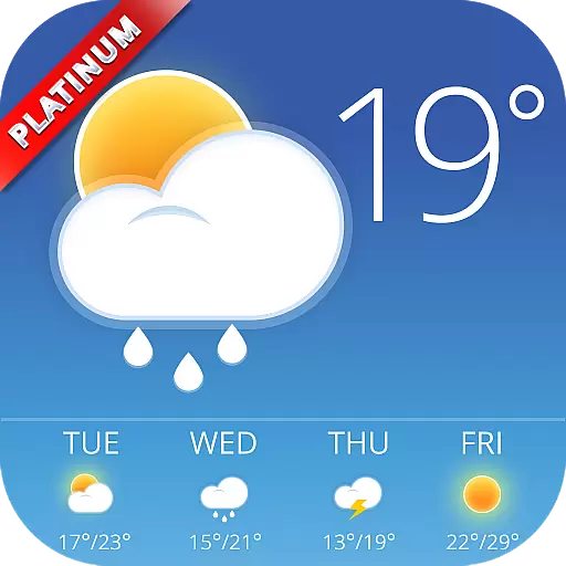
Nuts Weather, your ideal choice for knowing weather forecast & weather radar
4.70
Check room temperature with this indoor thermometer. thermostat & hydrometer
4.70
Get accurate rainfall and snowfall totals for pinpoint locations on a map.
4.60
72-hour weather & daily forecasts with extreme weather alerts
4.60
Weather related custom complications for Wear OS. UV, Hi-Lo, AQI and more!
4.40
Accurate weather forecast and beautiful weather & clock widgets
4.20
Personal Weather Station PRO - Meteo monitor to check your WU info and charts.
4.20
Live weather radar, widgets & forecasts. Track rain, storms & temperature.
4.20
Your local weather app with storm radar, rain tracker, weather maps & AQI.
4.3

User Reviews